
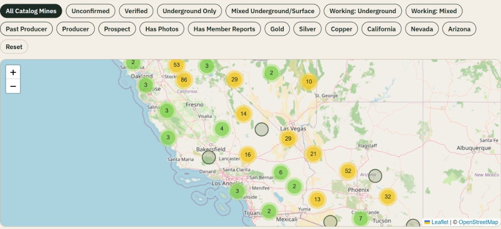
California underground mines
5,009 documented underground mines
California hosts one of the densest historic mining landscapes in the United States, from Mother Lode gold belts to desert tungsten, borate, and silver districts.
Open state mapUndergroundMines.com
A community-built database of documented underground mines, shafts, adits, tunnels and historic underground workings — focused on California, Nevada, and Arizona.
Help verify UndergroundMines records you already know or can support with reliable documentation.
Do not seek out dangerous unknown sites solely for verification.
Sign in to explore the interactive map. Markers show documented underground mines only; exact coordinates always remain gated by membership tier.
Create a free account or sign in to explore documented underground mines with filters, clustering, and approximate locations.
State indexes built from published underground mine records only.
5,009 documented underground mines
California hosts one of the densest historic mining landscapes in the United States, from Mother Lode gold belts to desert tungsten, borate, and silver districts.
Open state map3,387 documented underground mines
Nevada's mining history spans Comstock silver, Carlin-style gold, and hundreds of mountain-range districts across the Basin and Range.
Open state map3,507 documented underground mines
Arizona mining history includes major copper districts, historic gold camps, and extensive federal mineral-resource documentation across the Southwest.
Open state mapSelected underground catalog records with useful source depth, workings evidence, or historical documentation.
California
Unconfirmed Gold
Historical mapped workings available
California
Unconfirmed Gold
Historical mapped workings available
California
Unconfirmed Gold
Historical mapped workings available
Arizona
Unconfirmed Copper Mixed Underground/Surface
Documented shaft evidence
Nevada
Unconfirmed Gold
Historical mapped workings available
Arizona
Unconfirmed Lead
Historical mapped workings available
Nevada
Unconfirmed Silver
Historical mapped workings available
Arizona
Unconfirmed Copper Mixed Underground/Surface
Historical mapped workings available
Search underground mines by name, county, commodity, and coordinates with radius tools.
Every published record keeps source-backed underground evidence — USGS MRDS fields, workings notes, and citations.
Membership-aware maps separate public regional context from gated exact locations.
Submit new underground mines with workings evidence for moderation — surface prospects alone are not published.
Log the mines you've visited, group multiple mines into a trip, upload your photos, and share the story without sharing your stored mine locations.
Explorer Pro is for exploring and documenting underground mines: exact coordinates where publication rules allow, personal visit tracking, and private notebooks. Checkout remains disabled until a Stripe price is configured for this site.
View membership detailsA listing is not permission. Abandoned workings can contain unstable ground, vertical drops, water, and bad air. Public land does not mean underground entry is allowed. Read the safety notice and access disclaimer.